
L’Aquila did not emerge as the vision of a single ruler or architect. Instead, it was built collectively in the 13th century by roughly 71 fortified villages scattered across the Aterno valley. Each of these communities contributed people, materials, and skills, taking part in a coordinated effort to create a new urban center. This was not symbolic cooperation – it was a practical system in which every village physically constructed its own section within the city walls.
The allocation of space followed a clear rule. Each settlement received a plot based on the number of “fires,” meaning households. A larger population translated into a larger portion of land. Within that assigned area, each group built essential elements of urban life – a square, a fountain, and most importantly, a church. These churches were dedicated to the same patron saints as the original villages, ensuring continuity of identity. Even after many of those rural settlements declined or disappeared, their legacy remained embedded in the city’s religious and urban fabric.
In 1272, the Florentine planner Lucchesino da Firenze designed the overall layout of L’Aquila. The plan followed a traditional Roman model, structured around a main north–south axis (cardo) and an east–west axis (decumanus). These lines divided the city into four major medieval quarters. However, within this orderly grid existed a complex patchwork of smaller districts, each tied to a founding community. These districts, known as locali, preserved distinct identities, customs, and social networks.
This method of urban formation was highly unusual for medieval Europe. Most cities were established by centralized authority – kings, feudal lords, or ecclesiastical powers. L’Aquila, by contrast, developed through negotiation among rural populations seeking greater autonomy and protection from feudal control. The result was a shared civic project built piece by piece, reflecting both cooperation and local independence.
More than 750 years later, the original structure remains visible. The four historic quarters still define the city, and the internal divisions continue to follow the same layout established in the 13th century. Walking through the historic center today, one can still recognize how each square, church, and street corresponds to a specific founding village. The city itself acts as a living map of its origins.
Among the contributing settlements were Arischia, Assergi, Bagno, Barete, Bazzano, Camarda, Coppito, Paganica, Pizzoli, and Preturo, along with many others. Each brought its own population and resources, helping to shape a city that was both unified and diverse.
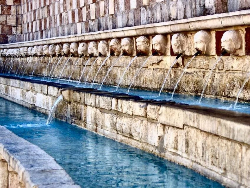
A well-known tradition associated with L’Aquila is the symbolic number 99. According to local lore, the city was formed with 99 squares, 99 churches, and 99 fountains. This idea is reflected in landmarks such as the Fountain of the 99 Spouts and in stories about bells ringing 99 times. While the number is not historically exact, it captures the concept of a city built from many parts.
The foundation of L’Aquila began around 1254 under Conrad IV and was further developed between 1266–1268 during the rule of Charles I of Anjou. The goal was to consolidate the region, but the process allowed local communities to play a central role in shaping the urban environment.
Some interpretations go further, suggesting symbolic links between L’Aquila and Jerusalem. These theories point to similarities in elevation – about 731 m for L’Aquila and roughly 750 m for Jerusalem – as well as comparable urban divisions into four quarters. Other ideas focus on numerology, noting recurring references to the number 9 and its multiples. These perspectives remain speculative but add to the city’s cultural narrative.
What remains clear is that L’Aquila represents a rare example of collective urban creation. Its streets, buildings, and layout still reflect the contributions of dozens of communities that came together to form a single city while preserving their individual identities.