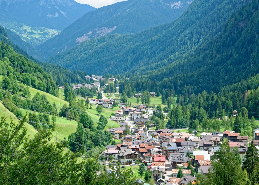

Climbing up the Pettorina Valley in the upper side of the Belluno province in Veneto and in the heart of the Dolomites, Sottoguda is the last village before Malga Ciapéla and the Marmolada Mountain.
The borgo, which is part of the municipality of Rocca Pietore, extends from Punta Penia, Marmolada’s peak (3342 mt), up to the whole Val Pettorina and to the right bank of the Alleghe Lake, and it includes beautiful and wild valleys such as Ombretta, Franzedas e Valbona.
Once a Lombard military settlement, Rocca Pietore from 1000 to around 1935 was part of the County of Tyrol and of the Brixen Diocese. Passed under the rule of the city of Belluno, for 411 years, until the advent of Napoleon, it was a small Republic – The Magnificent Community of the Fortress – with a strong autonomy.
Sottoguda is an ancient borgo whose written evidences date back to 1260. It is characterized by the numerous tablèi, wooden barns spread all over the Dolomitic area of Ladin Culture, used by farmers for hay’s storage and recovery of the livestock and agricultural tools.
Agriculture has been for centuries the main source of surviving for this small community. Today the tradition of the wrought iron manufacture survives thanks to some artisans that have their shops on the road connecting Sottoguda to the Palue village.
The most ancient building of Sottoguda, the only one survived at the 1881 fire, is the little Church of Saints Fabiano, Sebastiano and Rocco, consecrated in 1486, when it was supposed to serve a community of about ten residences. The bell tower dates back to 1550 and the altar to 1616.
After the last houses of the borgo, you’ll find the Gola dei Serrai (Serrai Gorge), a deep canyon of about two kilometers, today a regional Park. In winter, when the waterfalls freeze and cover the rock walls with a thick layer of ice, the gorge becomes an ice climbing gym renowned all over Europe.
Today large flocks of sheep pasture on the meadows, otherwise uncultivated. A new bike trail 11 kilometers long runs along the area connecting Sottoguda to the last village, Masarè.
A cableway leaves from Malga Ciapéla reaching Punta Rocca, up to 3309 meters, the second highest peak of the Marmolada and the entire Dolomites.
Among the many possible itineraries we mention three CAI trails departing from Sottoguda: the first leads to Forcella Valbona (2196 mt), inhabited only by ibexes and chamois, between firs, alders and blueberry plants; the second leads to Forcella delle Fontane (2211 mt.) climbing the old mule track and reaching the pastures; the third reaches the Malga Franzedàz (1980 mt.), a panoramic plateau spread with small barns and casére (kitchens of the shepherds).
In summer, every Thursday evening, Sottoguda livens up with the event “Na sera da Zacàn” – ancient arts and crafts. Food and music are the best expressions of artistic craft and ancient arts such as iron beating, wool manufacturing and wood carving.
The name
Guda is the ancient town name referring to a mountain of secondary importance. The name of the municipality, Rocca Pietore, has a military array that recalls the ancient fortress destroyed by the Bellunesis at the end of the fourteenth century.